Grosmont to Whitby
Canoe touring on the lower Esk
Commercial tours chuck in from the left bank about midway between Sleights and Ruswarp, but it’s a better day’s paddle in an open canoe from Grosmont. High water avoid. Medium water grade 1-2. In summer a lot of scraping. According to canoedaysout.com, access is disputed, but that’s mainly higher up. There’s not too much trouble below Grosmont. In May 2013 a fisherman grumbled that “The rivers public but the banks are private” when we got out to inspect the 1/4 mile weir. But below that the land is National Trust at least for a bit.
Through most of its length the Esk has cut through the same Middle Jurassic limestone formations as at the coast. However between Grosmont and Staithes it cuts through the older, but still Jurassic, middle and upper Lias. For a few hundred feet below railway bridge 3 the lower Lias with is characteristic Ammonites capricornus is exposed.
There are freshwater pearl mussels above Grosmont, but they’re allegedly declining.
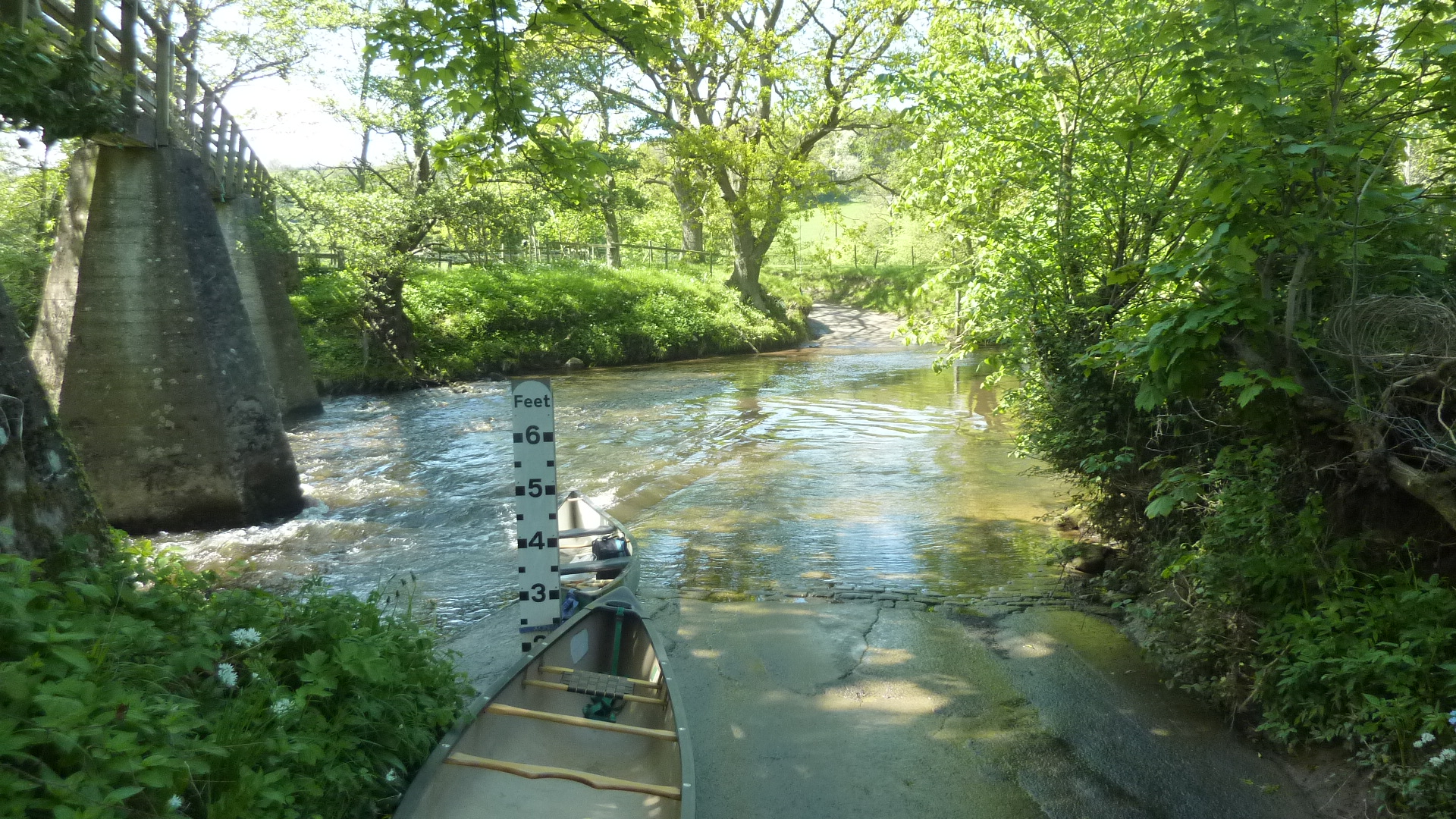
0 miles – Grosmont ford. Footbridge. If the marker is 1-2 feet it’ll be OK.

100 yds – Murk Esk joins right

200 yds – road bridge. Small rapid above and step below


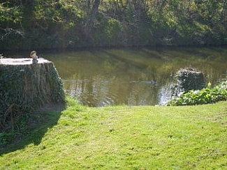
1/4 mile – disused farm bridge. Pier of what looks like an old railway bridge just below. Rocky weir. Not shootable at low water. Tricky but possible line down from right bank. Rapid below. Access is possible below the weir via the car park between Grosmont and the road bridge. At low water this might be a better starting point.


The Priory left. The actor Ian Carmichael (Lucky Jim, Bertie Wooster, Lord Peter Wimsey) lived here till his death in 2010
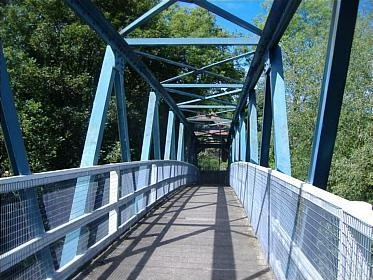
0.5 mile – railway bridge 1. The famous Whitby to Pickering, begun only seven years after the Stockton and Darlington and surveyed by George Stevenson himself, was one of the world’s earliest lines. It opened in 1838, horse drawn, until gradually converting to steam after 1845. The North Yorkshire Moors Railway Charitable Trust now runs steam trains daily between April and October and selected winter weekends. Criss-crossing the river, it is the UK’s busiest heritage railway.
0.75 miles – railway bridge 2.
1 miles – railway bridge 3. More riffles. The cliff exposures here are Lower Lias. Ammonites capricornus have been found, but they are not numerous.
1.5 miles – railway bridge 4.
2 miles – railway bridge 5.
2.5 – railway bridge 6.
2.75 – railway bridge 7.
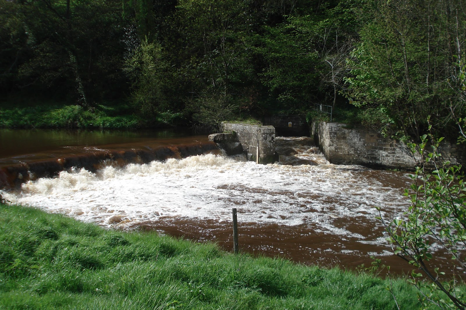
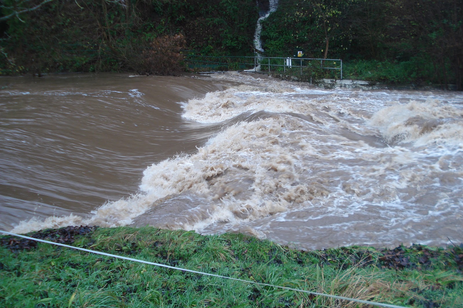
Sleights weir 50 yds before the road bridge. Portage right. Not shootable. Pictures below at low, medium and high water.

Path to Salmon Leap Pub car park involves crossing the line.
3 miles – A169 bridge
Sleights right. Briggswath left.
3.25 miles – footbridge
3.5 miles – landing and car park left. Roman settlement
4 miles – access left.
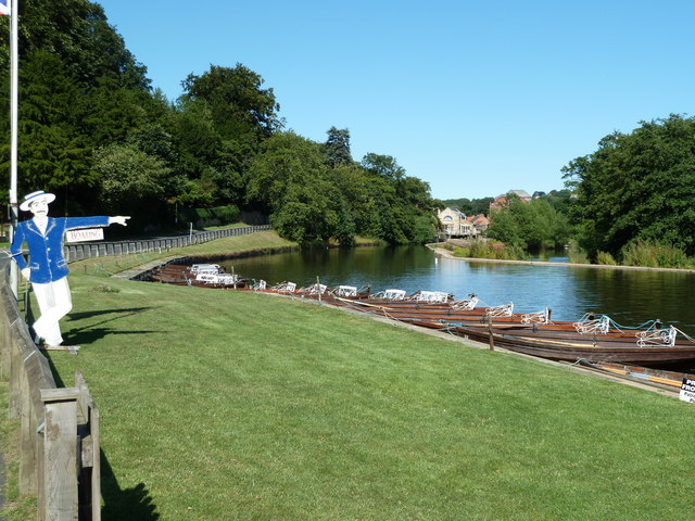
4.5 miles – Ruswarp pleasure boats left. Ruswarp weir right


At low water carry over, or shoot the channel in the middle of the weir. There are plans to install a 50KW hydroelectric power station at the right hand end between the fish pass and the bank.
Tidal from here.
4.75 miles – Ruswarp railway bridge
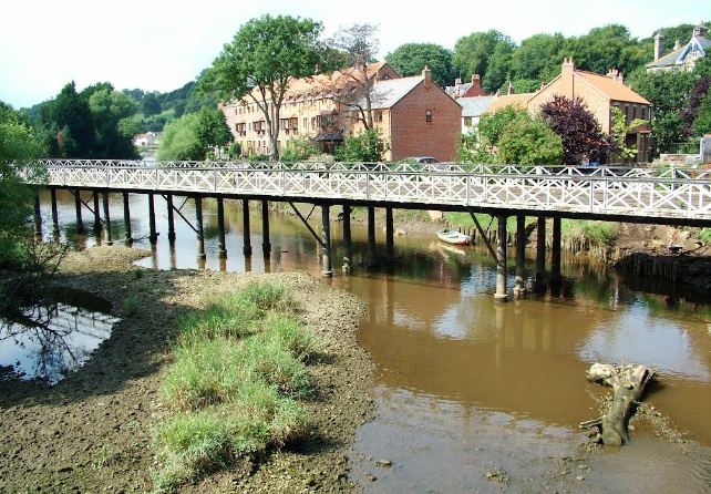
Ruswarp iron bridge (1930) carrying the B1416 immediately after. This iron bridge, allegedly built from the same iron as the Sydney Harbour Bridge. An earlier suspension bridge was destroyed by floods in 1828, and its successor went the same way in 1930.


5 miles – Rigg Mill beck joins right
5.25 miles – Larpool viaduct (1885)
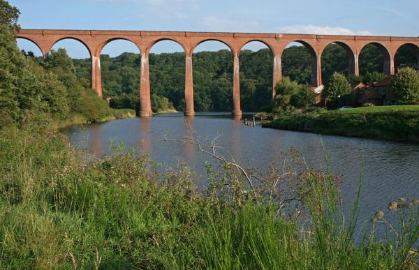
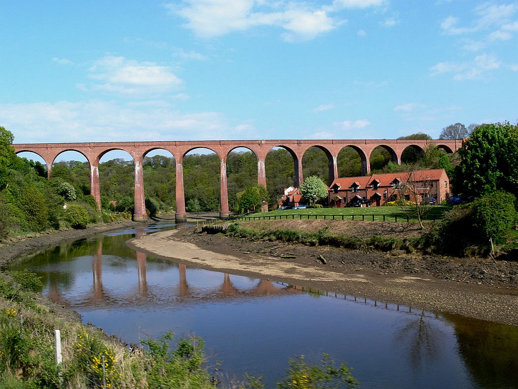
Originally carryied the coast railway from Scarborough into Whitby. The line was never profitable and was closed by Beeching in 1965. Now a cycle track.
5.5 miles – A171 bridge
About 100 yards further on the left is a public slipway and the station car park. Exit.
Jim Thornton
